HISTORY OF
WANDSWORTH COMMON
Added 29.4.2019
IN PROGRESS — NOT FOR PUBLICATION
Where was Ivy House?
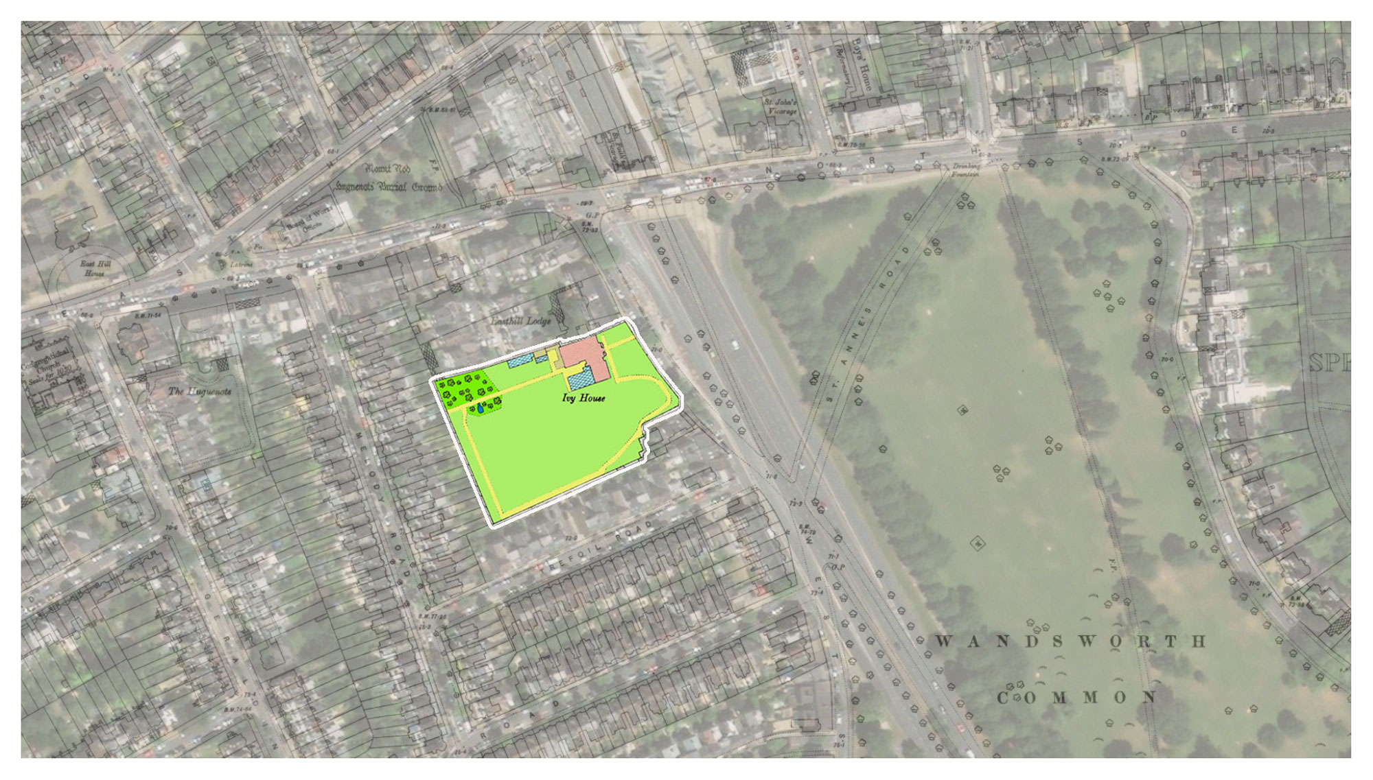
Ivy House and garden: their C19 footprint superimposed on a recent aerial view.
Notice the dual carriageways of Trinity Rd leading to the southern end of the underpass (top centre). East Hill crosses left to right. A few hundred yards the amoeba-like Spencer Park engulfs part of the Common from the east.
[Source: Ordnance Survey 60-inch to the mile, c.1893. [ref/link]]
(Click on image to enlarge)
Finding Ivy House turned out to be quite a challenge, which rather surprised me. After all, Geoffrey Bevington's photographs showed it was a large house, with substantial grounds, and census data and other sources showed it had been inhabited throughout the nineteenth century. However, it seems Ivy House was not quite big enough to be routinely named on most maps (even 6-inch maps, such as Stanford's).
Although Ivy House was listed in several Censuses, its location (and that of its neighbouring houses) was unusually vague and variable. In the 1841 Census it is referred to as on "St Anne's Lane", plain "Wandsworth Common" in 1851, and "Wandsworth All Saints" in 1871. (I have yet to find Ivy House in 1861, 1881, 1891, but I expect they'll turn up eventually. They're probably hiding in plain sight.)
This is not entirely surprising because there were relatively few houses in the area, and roads were often not named at all, or the names changed throughout the century ("Allfarthing Lane", for example, is particularly variable). Moreover the modern pattern of streets was not laid out until the end of the century, when most of the terraced houses now present were built. It was only then that street names were more permanently established.
The Tithe Apportionment map, c.1841
I reasoned that Ivy House, or at least James Bevington as a prominent Wandsworth householder, would feature on the Tithe Apportionment map of c.1841. It was a good guess, and very pleasing indeed to find the Bevington family's home listed as on plot 327. But when I inspected the map, Plot 327 looked much too small.
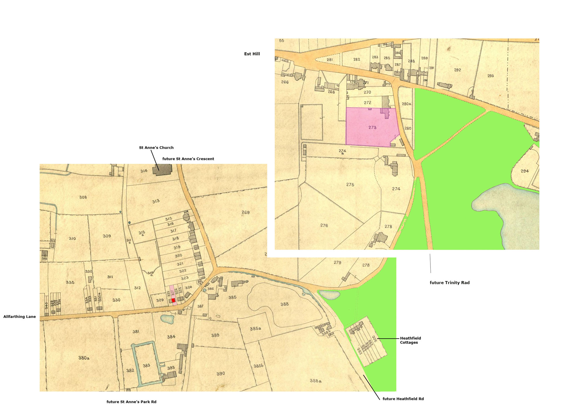
The Tithe Apportionment c.1841 lists "J. Bevington" as renting a small plot, numbered 327 (left/below). Ivy House, however, was on plot 273 (right/above), further up the road, facing Wandsworth Common.
[Source:etc. Tinted by PB.]
(Click on image to enlarge)
This is what I wrote at the time:
Plot 327 looks far too small to be "Ivy House", the gardens of which seem vast - certainly roomy enough to have a croquet lawn, vegetable plot, wild area etc. I
The photographs suggest Ivy House's footprint/ground-plan was quite complex - with substantial additions, including a conservatory.
Also, the house looks on the tithe map to be the right-hand house of a semi-detached pair. Unless all the photographs of Ivy House have been flipped, they all show it as the left hand house.
I eventually found out the Ivy House was in fact on the Tithe map's Plot 273, further up the road. This puzzle led me up the garden path for more than a week.
There are at least two possible explanations.
At first I thought it was a simple transcription error - the transposition of a couple of numbers in the online records: "273" could so easily have been turned into "327". But on checking the original I found it wasn't the recent transcriber's fault - they had kept faithfully to the C19 manuscript. In which case, was the original hand at fault?
Possibly, but it also occurs to me that the Bevingtons might have moved first from Bermondsey to another, smaller house on Plot 327, before moving along the road to Ivy House on plot 273.
Further evidence might come in, but in the meanwhile this is all we've got.
Ivy House, c.1841
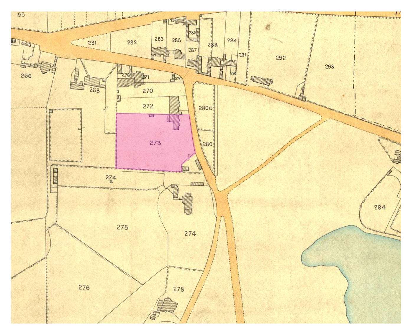
Plot 273, Ivy House and garden, Wandsworth Common, c.1841. The Bevingtons had moved to Wandsworth a few years earlier. Geoffrey was born here in 1838.
Notice two fenced-off plots opposite. Unusually, these were returned to the Common before the 1890s.
[Source: Tithe Apportionment c.1841 [ref/link].]
(Click on image to enlarge)
Stanford's, 1864 [sic?]
Ivy House is not named, but can easily be found.
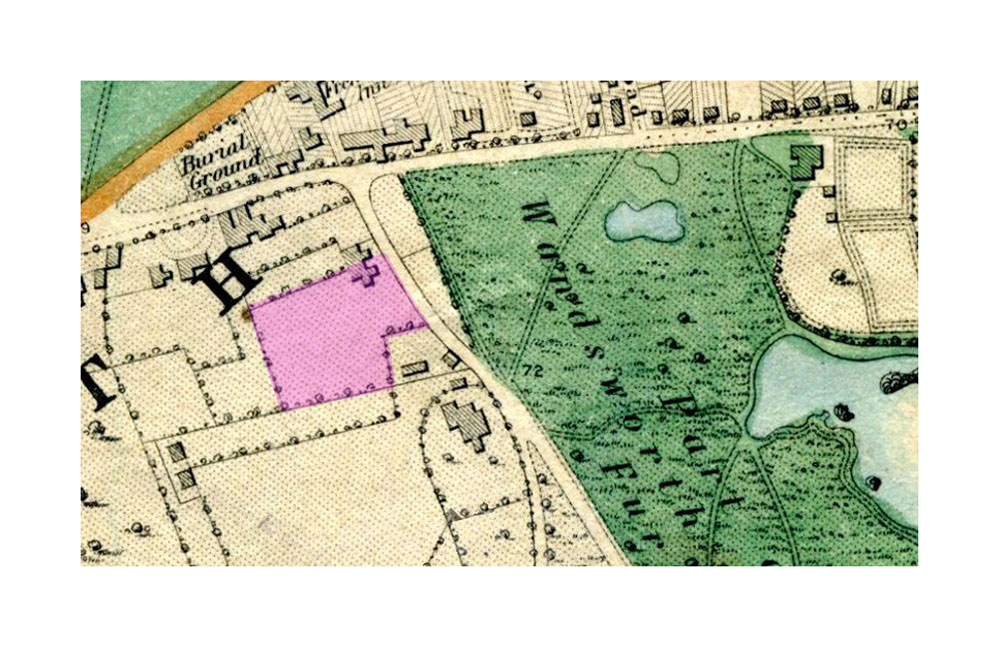
Ivy House and garden, Wandsworth Common, c.1864. Geoffrey Bevington's photographs mainly date from this time.
[Source: Stanford's [title] [ref/link].]
(Click on image to enlarge)
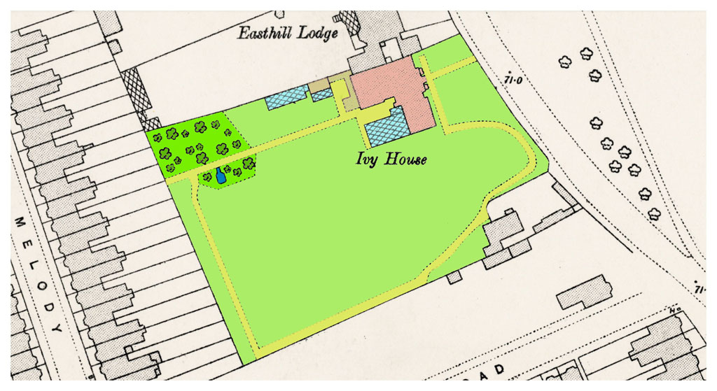
Ivy House and garden mapped c.1893
Geoffrey Bevington had died in 1872 [check). His father and brother moved away shortly after (to Bromley, and then to Sevenoaks). Ivy House and the neighbouring Easthill Lodge are still intact in 1893. But notice the fields and the large houses that used to stand nearby have been largely built upon. The small back gardens of terraced houses in the new "Melody Road" butt up against the rear wall of Ivy House. "Trefoil Road" has been half-completed to the south.
[Source: Ordnance Survey, 60-inch to the mile, c.1893. [ref/link]. Tinted by PB.]
(Click on image to enlarge)
To follow up . . .
Who lived here in 1881, 1891?
Locate the Sheppard/DuBuisson boundary wall on which the plaque is situated.
1881 Census: 1881
1891 Census: 1891
What happened next?
At the end of the nineteenth century, terraced houses were built throughout the area - including on the site of Ivy House. After Melody and Trefoil Roads had been completed, Acris Road was built straight across the middle of the Ivy House plot.
Terraced housing on the Ivy House site, built around 1900
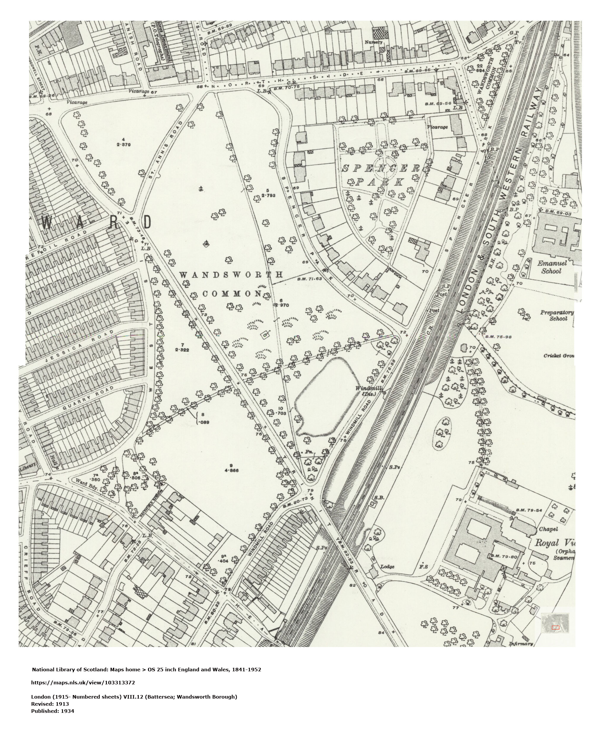
Top left: Terraced housing on the Ivy House site, built around 1900. Ordnance Survey, revised 1913, published 1934.
(Click on image to enlarge)
Total destruction by V-1 Flying Bomb ("Doodlebug"), [1944?]
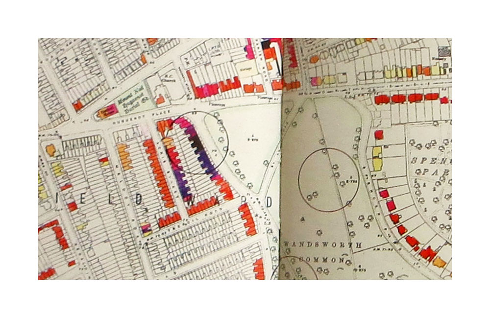

From The London County Council Bomb Damage Maps, 1939-1945.
(Click on image to enlarge)
- Wikipedia: V-1 Flying Bomb
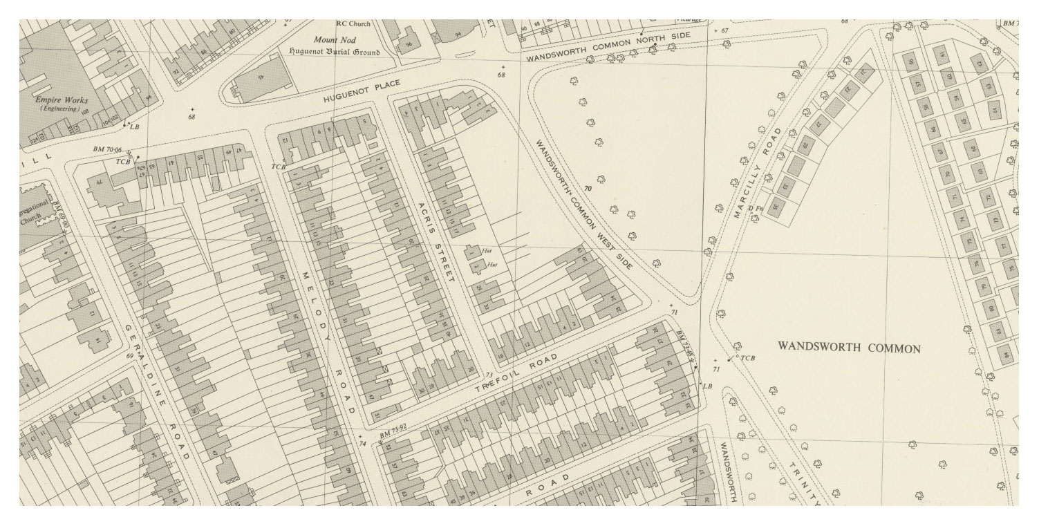
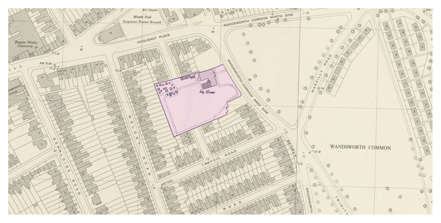
The area mapped soon after the war.
The terraced houses built on the the site of Ivy House and Easthill Lodge have themselves gone, destroyed at the end of the war. The map [date?] shows no building on the bombsite.
Notice, incidentally, the numerous prefabs two- and three-deep along Spencer Park, and a single row along one side of Marcilly Raad. These were built c.?, and demolished in ?. Notice the ghostly virtual presence of Marcilly Road (previously called St Anne's Road). When the Trinity Road underpass was built in the ?1960s, it was grassed over - notice the slightly curved avenue of trees that once lined it.
(Click on image to enlarge)
And after that?
Around 1960?, a long block of flats was built on the front of the plot of what had been Ivy House and its neighbour, Easthill Lodge.
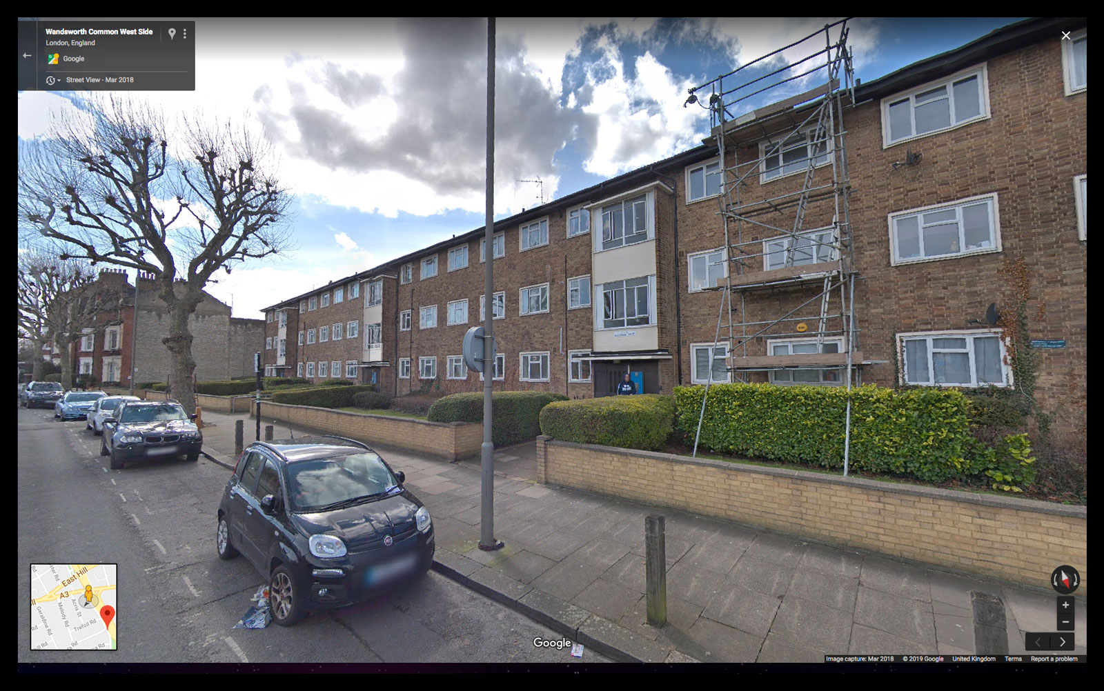
Image: Google Maps April 2019.
(Click on image to enlarge)
— In Search of Geoffrey Bevington (1838-1872) [start here]
— Geoffrey Bevington's Photograph Album in the V&A
— Portraits of Geoffrey Bevington
— Ivy House, Wandsworth Common
— Bevingtons and Sons Leather Manufactory, Neckinger Mills, Bermondsey
— Samuel Bourne Bevington [GB's big brother] (1832-1907) [Who's Who of the fight over enclosure]