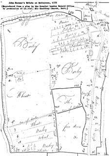
Fig. 1. John Baron’s Estate at Battersea, 1775.
Reader’s version of Build 11 — last modified 31 October 2026
Part 1 of The Five Houses of Wandsworth Common
This section looks to / In this section, we give a broader sense of the natural landscape surrounding the Five Houses, and draw on other large local properties and their gardens.
is this * The Survey of London mentioned above? encapsulates the changes that took place to the local landscape of Wandsworth Common between the mid 18c 18th century and the early 20c 20th century:
“Cushioned between wide open spaces, far from the council estates and railways that crowd the north of the parish, this area is today best known for its gridded streets of Victorian and Edwardian housing, built up from the 1850s, constituting Battersea’s latter-day middle-class heartland . . . For 100 years before, this was a very different kind of district: a verdant, genteel suburb of large private villas, wooded grounds and farmland, through which ran the watercourse called the Falcon Brook, on the route of present-day Northcote Road. It is with this lost elysium that . . .”
This section looks to give a broader sense of the natural landscape surrounding the Five Houses and draws on other large local properties and their gardens. It covers changes that took place to the local landscape of Wandsworth Common between the mid-18th century and the early 20th century.
Note to self: In 1763 Frederick St John (= 2nd Viscount Bolingbroke and 3rd Viscount St John), sold the manor of Battersea and Wandsworth to his wife’s cousin, John Spencer, Viscount Spencer, who became 1st Earl Spencer in 1765. > Earl Spencer (1765) → Conservators (1871) → MBW (1887) → LCC (1889) → GLC (1965) → Wandsworth Council (1970s/1980s).]
When the Five Houses were built in 1777 the landscape was rural and open having been agricultural - arable, pasture and meadow as shown by John Rocque's maps. Within this verdant green environment, the Five Houses were created foreshadowing Victorian ribbon development in the mid- late 19c. This map of 1761 (below) shows fields all around and undulating ground lying in parallel to east and west of the lane which was initially to become Five Houses Lane.
John Rocque's map of 1761 shows fields all around and undulating ground lying in parallel to east and west of the lane which was initially to become Five Houses Lane.
The fall of ground from this lane down to the Falcon Brook (now under Northcote Road) to the east gave the Five Houses an elevated position and an outlook to the east that remains a topographic feature today. Bolingbroke Farm is shown in the northeast corner and approached by a main route (now Battersea Rise). The eastern road parallel to Bolingbroke Grove is now a ghost road. The area to become Wandsworth Common is shown as rough land known to be poor, with gravel areas and prone to flooding.
In 1719 Kings Farm (later Bolingbroke Farm), owned by Thomas and John King, was probably a 100-acre holding shown by the 1775 Harman map and an isolated farm complex with few other buildings around. It is shown as growing crops of barley, wheat and potatoes in strips.
Tenants were typically farmers, yeomen, gardeners and labourers.
Fig. 1. John Baron’s Estate at Battersea, 1775.
The 1787 Corris map (Fig. 2) of Wandsworth shows open fields divided into shots or furlongs which were units of cultivation, themselves divided into strips (as can be seen in the Harman map). Their names - Gravel shot, Middle shot, South meadow shot, Long shot -.
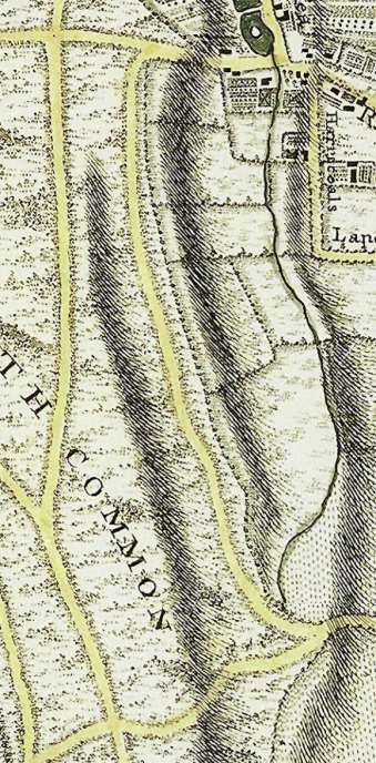
Fig. 2. Map of the area in the late 18th century (detail).
There were few enclosures in 1787 on East Common (now part of Wandsworth Common) compared to Wandsworth West Common (now part of Wimbledon Common).
had an unusually large proportion of land and employment given over to market gardens, providing cash crops such as fruit, vegetables and flowers to London markets. The rising land values meant many market gardens gave way to ribbon development along roads. Despite the increase in building development in general, there were far fewer large houses in the Battersea parish at this time compared with Clapham, Putney and Roehampton. Within 50 years, though, the population would increase from 4,000 to 120,000.
Thomas Milne's map of 1800 shows land marked as “P”, meaning “Paddocks and Little Parks” – this is true for Bolingbroke Farm and Dent’s Farm which, interestingly, is not described as “A” (“Arable”) or “M” (“Meadow and pasture”_.
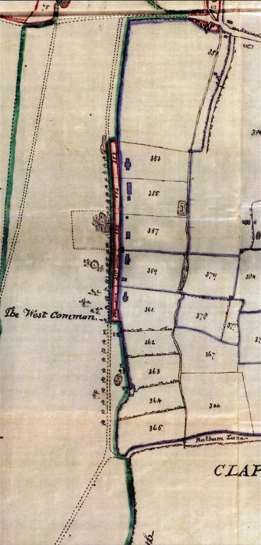
Fig. 3. Map detail.
The area marked Wandsworth Common remains rough land with tracks running through, so reminiscent of the Rocque map of 1761. Three of these tracks relate to the modern-day Bolingbroke Grove, Bellevue Road and Trinity Road. It is interesting to note that this swathe of land is described as Wandsworth Common to the north and west and Battersea Common to the south and east.
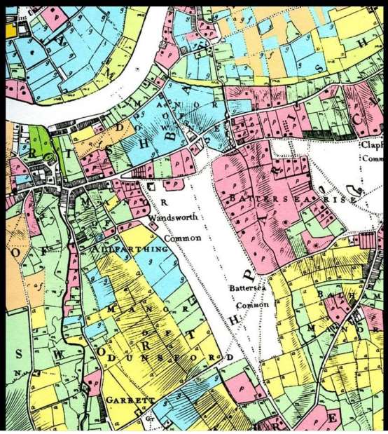
Fig. 4. Thomas Milne, land-use map of London and environs, 1800 (detail).
This once-agricultural area is shown in the Tithe map of as a mix of arable land, pasture and meadow and the emergence of pleasure grounds and gardens. This map also shows the widening of the Falcon Brook to make ponds or lakes which was characteristic of Capability Brown's style. It also clearly shows the appearance of formalized routes for carriages and transport.
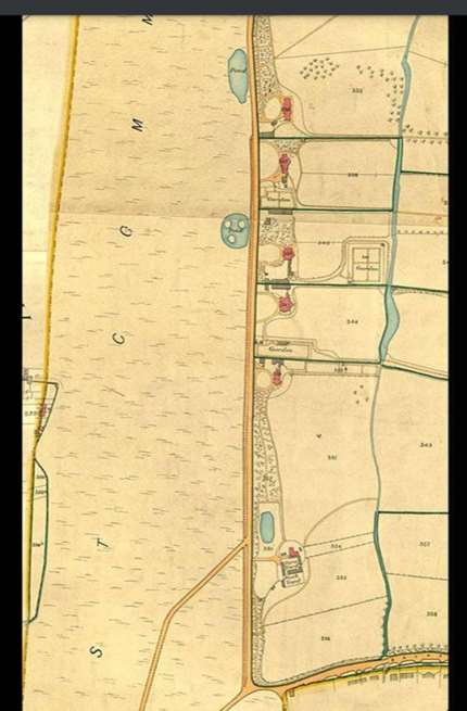
Fig. 5. Battersea tithe map (detail): the Five Houses along the edge of the Common.
The apportionment book supporting the Tithe map describes land in different terms. For example, we have been unable to clarify the meaning of Upper Bramlands, an area north of Battersea Rise. The name may refer to an individual, or "bram" may mean brambles or gorse so perhaps – as we know gorse was prevalent in the area – it referred to a type of vegetation.
Another is “Long Shot”. We do know that a “shot” could refer to a strip of land so it may describe the long rectangular shape of the area.
The reference to Flood Marsh is self-explanatory in confirming the damp conditions,
A decade after the Tithe Map, the Morning Herald 1853 describes Bolingbroke Grove House as having “riding horses, looseboxes for hunters”. While the royal parks had long disallowed hunting, hunting in the Surrey Hills and on the North Downs of Kent would have been accessible from here. Beyond the ubiquitous carriage horses, there is mention of riding horses. Would they have taken gentle hacks on the Common opposite or local open spaces such as Clapham and Tooting Commons, newly created Battersea Park (formerly Battersea Fields) or beyond to Wimbledon and Richmond?
It is also clear that all the significant houses or estates had stables for horses, if not for sporting pursuits but at least for, as the image below shows.
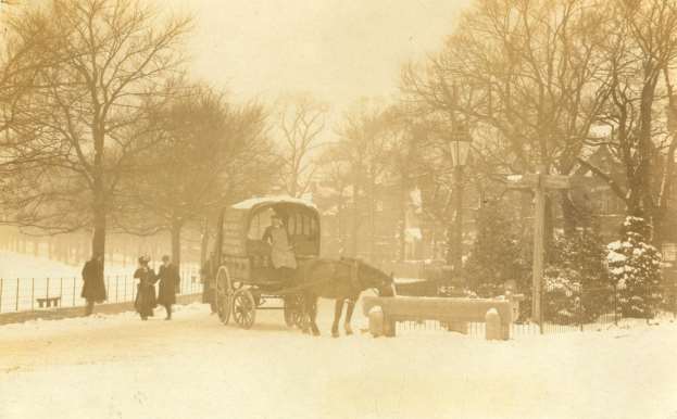
Fig. 6. A carriage on Bolingbroke Grove in the snow (postcard).
The image below, although taken later than the period referred to here (c.1914), shows a view of Wandsworth Common with established trees and large dark shrubs in the distance which could have been gorse or similar.
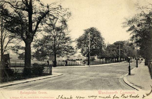
Fig. 7. Wandsworth Common, c.1914 (postcard).
It is also interesting in its depiction of four recent arrivals for the time but which still exist today. Just beyond the London Brighton and South Coast Railway running parallel to Bolingbroke Grove, lies the Royal Victoria Patriotic Asylum (now Building), the Surrey House of Correction (now Wandsworth Prison), a large plant nursery (now Capital Gardens/Neal’s Nurseries), and the County Arms (name unchanged). The large Battersea Cemetery is shown (its land having been acquired from part of the Bolingbroke House estate). The Bolingbroke Estate by Chatham Road is shown and is a prime example of a local prominent house (Bolingbroke Grove House) being demolished to make way for ribbon development [?] of an assortment of terraced, semi-detached, and detached properties with a scattering of pubs and shops. We can see Nightingale Cottage to the south and further housing appearing around St John’s Hill and Spencer Park. This map also shows an emerging network of major roads contouring the Common with major and minor roads running off these main arteries. By 1852 St James Industrial School was established just south of Wandsworth Common.
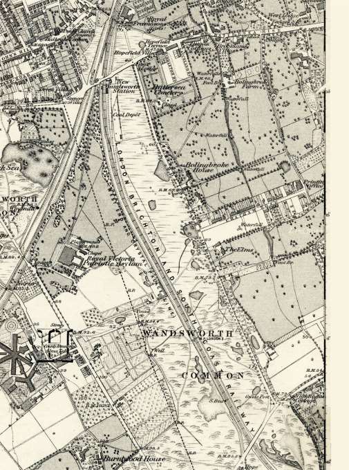
Fig. 8. Ordnance Survey map of the 1860s (detail).
The census records show during mid 19c the following staff descriptions which indicates the: 1861 - garden servant for Bolingbroke Grove House For the scale of property we can assume maintenance of the extensive grounds was carried out by labour living both in these houses or elsewhere.
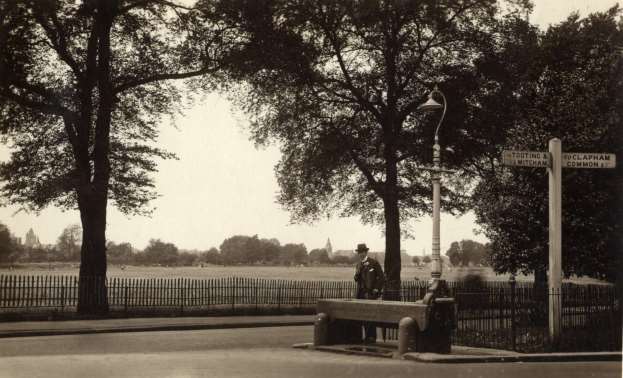
Fig. 9. Wandsworth Common, c.1900 (postcard).
To conclude, drawing information from census details and the commercial aspects of the wider area shows how the early part of our period – early to mid 19th century – was a turning point.
The 1851 census quotes a population of 10,560, and a small proportion, around 300, lived in South Battersea, mainly within the 28 large houses “between the Commons”. Roger Logan stresses how few of the residents then could have imagined the changes that were about to alter their local landscape. He also points out that some, by looking north, seeing the development of Battersea New Town and Nine Elms, may have sensed dramatic change ahead.
Logan continues:
Picture yourself at the crossroads of Battersea Rise and Bolingbroke Grove. Look south along the Grove, wending its undulating way towards Nightingale Lane, and observe on the right the rough open expanse of Battersea West Common (what is now part of Wandsworth Common). Only one railway line crosses the Common…
In the middle distance … is a windmill and behind the newly built Surrey House of Correction, better known now as Wandsworth Prison. From the spot where you are standing, look down Battersea Rise noting the few cottages that exist thereabouts. Further east, on the other side of the valley, is a substantial house, with other houses and their grounds stretching away into the distance along the edge of Battersea East Common (part of Clapham Common).
Down in the valley bottom is a stream, the Falcon Brook; by the side of it is a farm . . . Open land exists between that farm, our vantage point, and the first of the five big houses in Bolingbroke Grove, on the site of Bolingbroke Hospital. It is in Bolingbroke Grove that this history begins…”
(Roger Logan, “Between the Commons, South Battersea's Formative Years 1851–1900”, Wandsworth Historical Society, Wandsworth Paper 15.)
As a final visual signpost to how Bolingbroke Grove looked at the end of the 19th and start of the 20th century, the images below are evocative of a moment in time when life was changing at pace.
The first image, of 1883, shows the view from Bolingbroke Hospital in 1883, showing the west-facing view across Wandsworth Common – an aspect which also provided fresh air for the patients. The Common was probably still quite rough and wild.
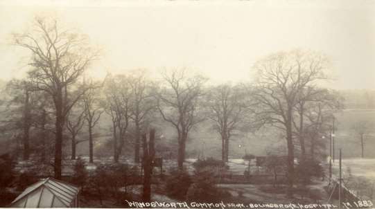
Fig. 10. Wandsworth Common from Bolingbroke Hospital, 1883.
The second image, of 1910, shows the twin row of formally planted, established and single species trees lining Bolingbroke Grove. The path looks of hard materials of stone and gravel while now it is grass and compacted earth. Ironically, this image shows the area to be more formal than we see today – a revealing fact that in recent years the Common has become more naturalistic and the ecological management allows for more biodiversity and informality.
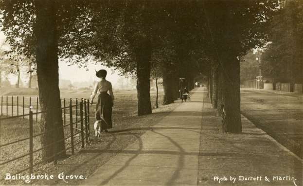
Fig. 11. Bolingbroke Grove, c.1910.
There is very little remaining for the Five Houses and pre-Victorian days except for a stable-block to Dent’s House between Gorst and Broomwood Roads but it is surrounded by houses, and reached only by an alley from 1B Gorst Rd. There is also a length of old boundary wall between the garden of 35 and 36 Bolingbroke Grove still visible from Bolingbroke Grove.]