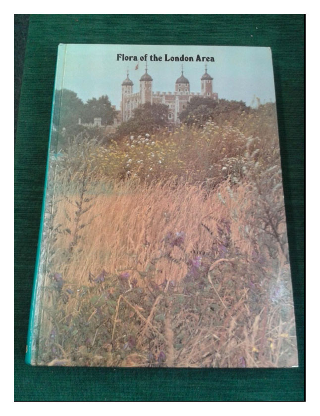
Rodney Burton's extraordinary work maps the distribution of more than 2000 plants found in London and its suburbs (mainly in the 1960s and 1970s).
Here is just one example, Alopecurus aequalis (the modern synonym for "Alopecurus fulvus" or Herb Smith) once seen "in great perfection on Wandsworth Common".
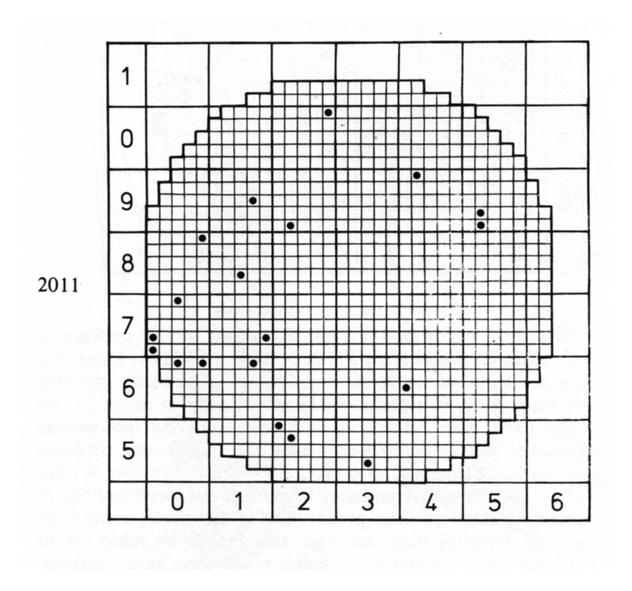
But where in this knitting pattern is Wandsworth Common?
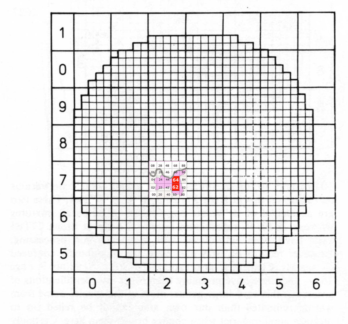
Strangely (in my view) the Burton's Flora does not provide a detailed map of London to help the reader work locations out. This is the only guide there is in the book - fairly rough and ready sketch (I have coloured in Wandsworth).
The big square is 70 km across - made up of 7 x 7 squares, each 10km across (hence they're called "centads").
The Borough of Wandsworth (which I've coloured pink) is in centad 27 [i.e. 2 across, 7 up].
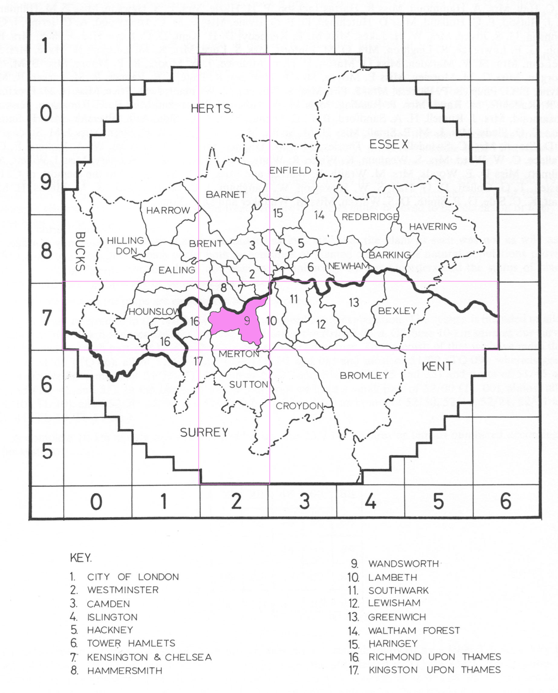
But clearly this is still too large an area to be really useful for locating species in any detail (e.g. nearly half of the Wandsworth centad is north of the Thames, and othr boroughs also shoulder their way in to east, west and south.
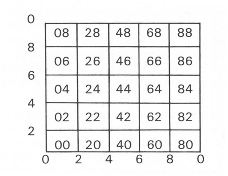
Hence each centad has been subdivided into "tetrads", each 2km across and 2km deep. They are numbered as follows:
So I superimposed the grid on a modern digital map (adjusted for scale). Even though the original sketch map was relatively crudely drawn, it matched the Thames and Wandsworth's boundaries quite well:
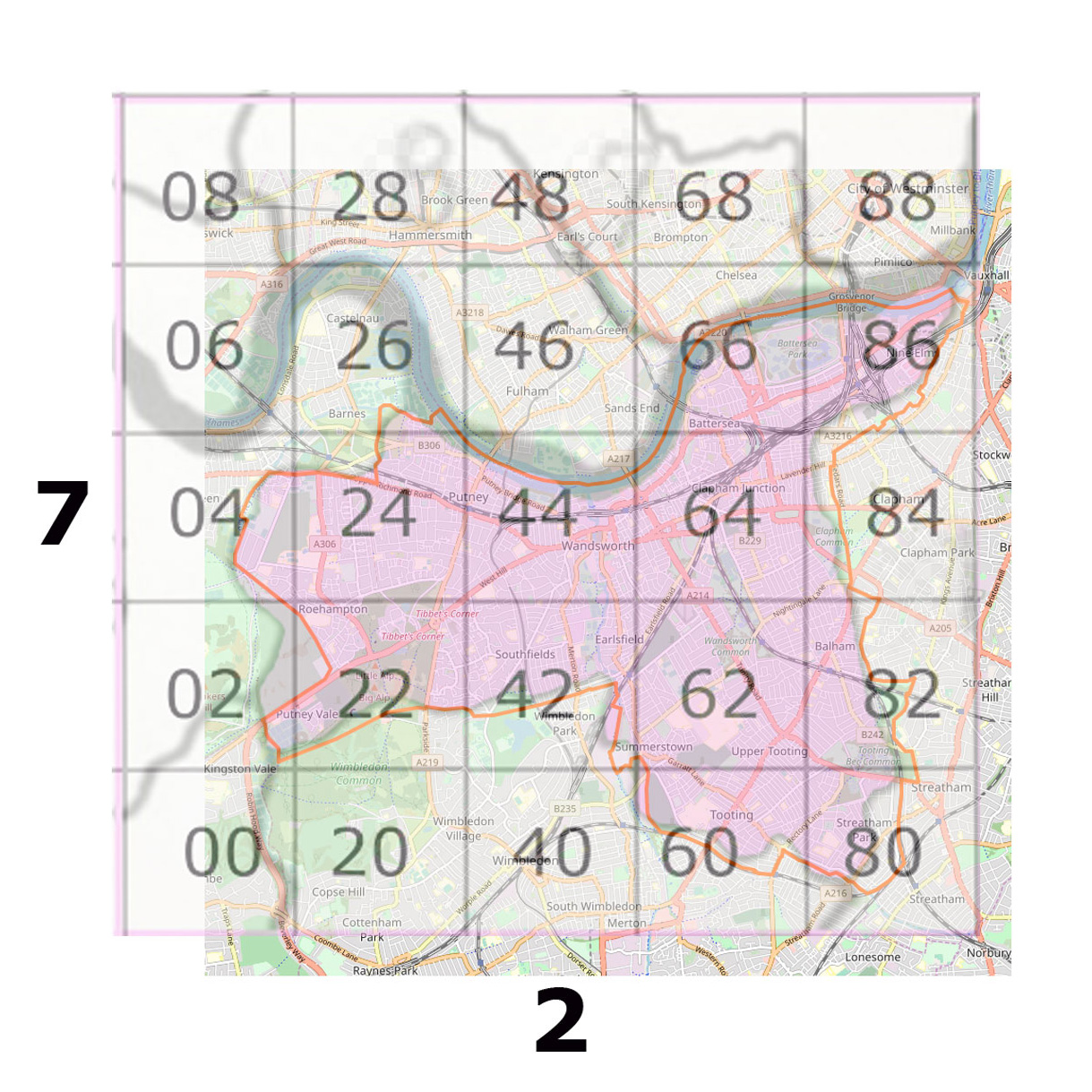
The southern part of Wandsworth Common is clearly in tetrad 62, and the northern part in tetrad 64.
Therefore, by the convention used in Burton's book, Wandsworth Common is "27T62" and "27T64". Get it?
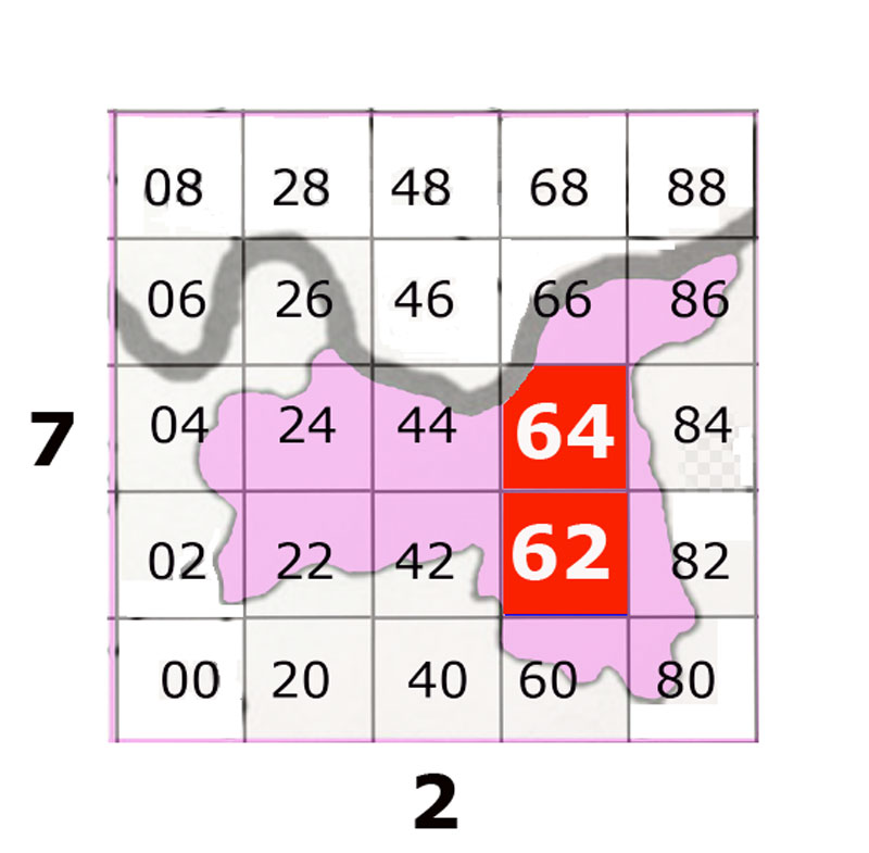
[Wandsworth Common (south) is "27T62" and Wandsworth Common (north) is "27T64".]
Here is Wandsworth and Wandsworth Common located on the map of London as a whole:
Let's returning to Alopecurus aequalis / Herb Smith. Once a local glory, by the 1960s and 1970s it could not be found on Wandsworth Common (or indeed anywhere else in adjacent centads 26, 23, 28, 37, 38):
