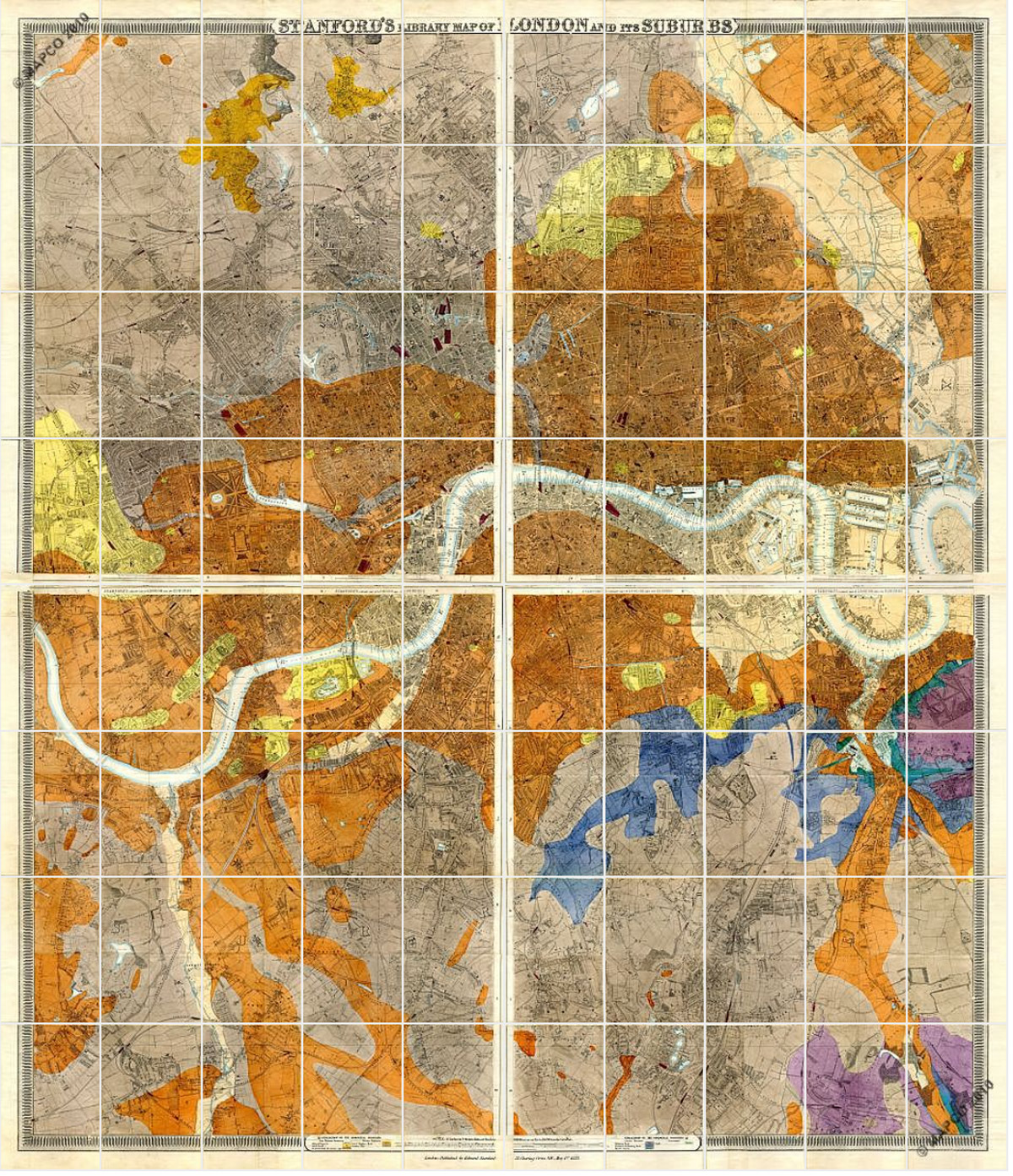
Edward Stanford’s Geological Library Map of London and its Suburbs of 1878 overlays the standard Library Map with colour-coded geological data, showing the underlying geology of London and its surrounds. The geology of Wandsworth Common — its gravel terraces, clay, and chalk — is directly relevant to the history of the Common: gravel extraction was one of the principal causes of the pitting and ponding that made the Common so distinctive, and the underlying chalk is what gives the Wandle its exceptional purity as a chalk stream.
Stanford’s Geological Library Map of London and its Suburbs, 1878. Wide view showing London and surrounds. The colour coding reveals the geological strata underlying the city. (london1878.com)
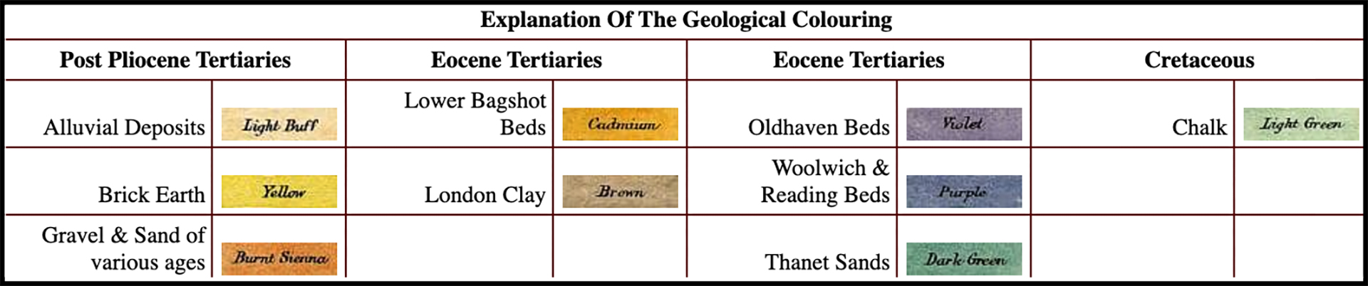
Key to the geological colour coding used on Stanford’s 1878 map.
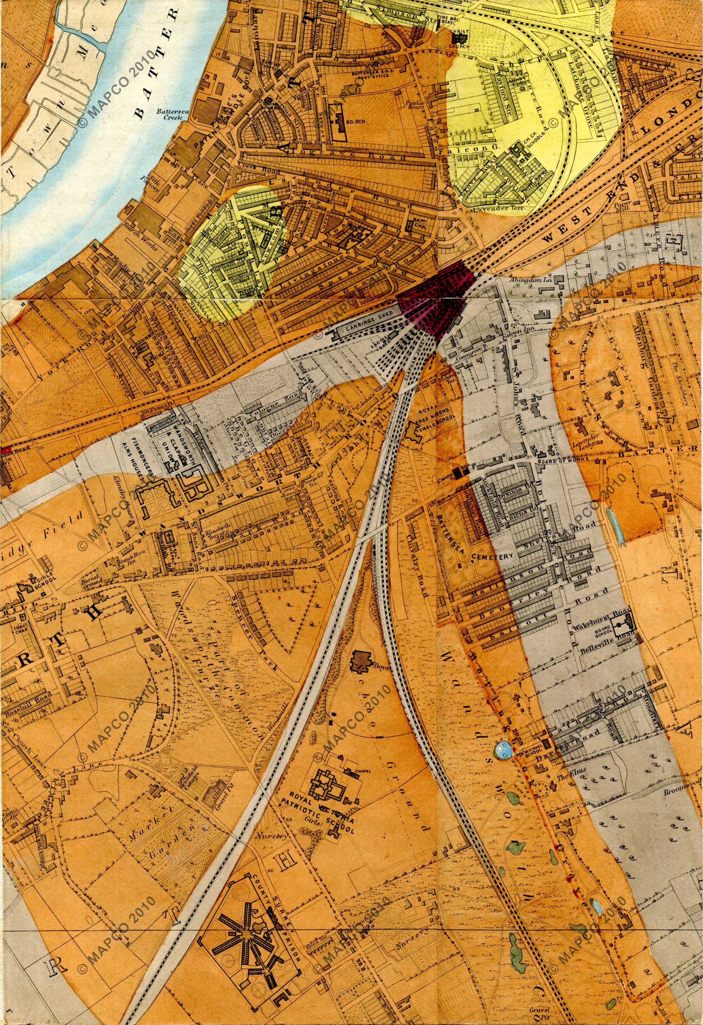
Stanford’s Geological Library Map, 1878. Sheet 48b: Wandsworth Common north. (london1878.com/stanford48.htm)
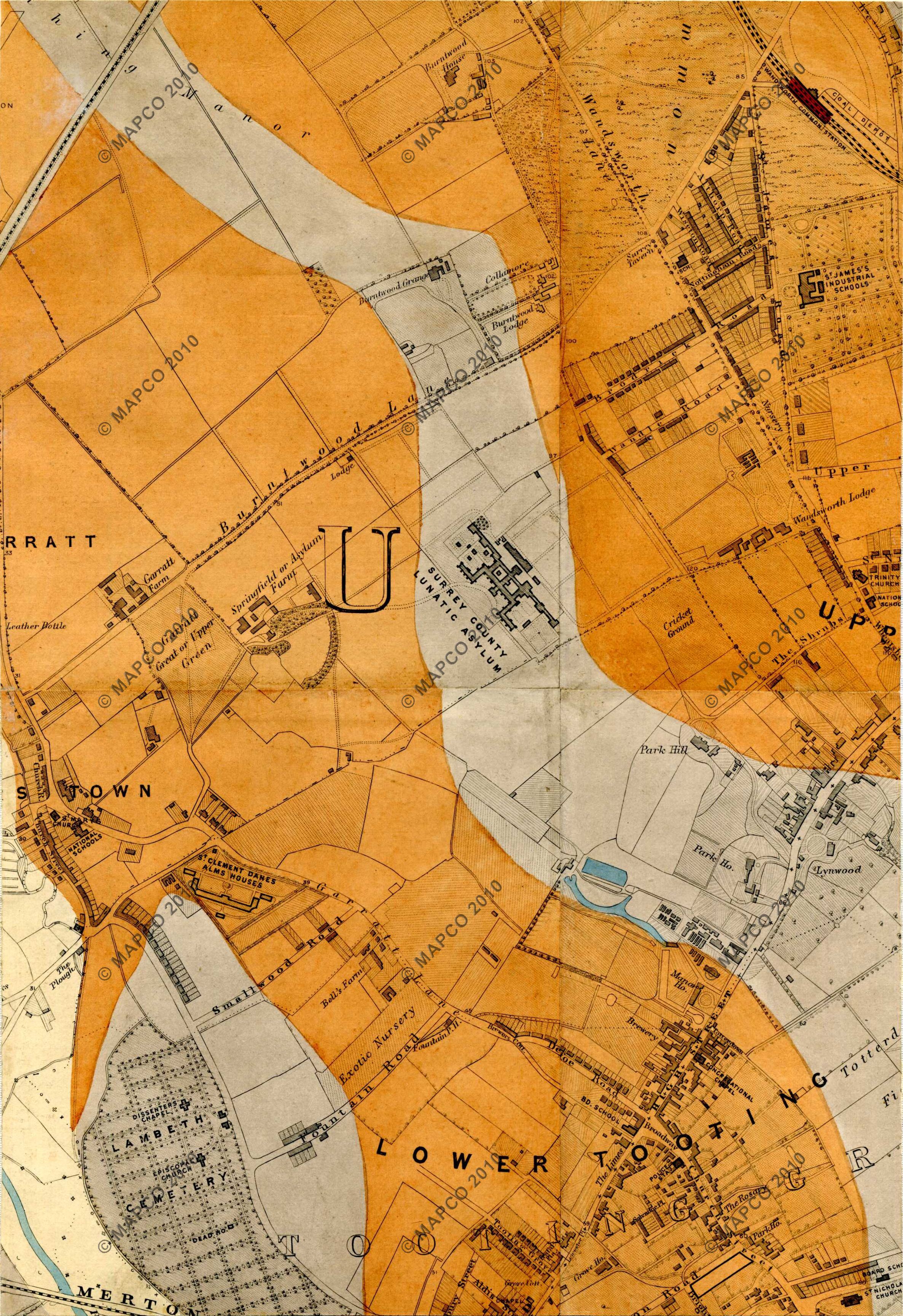
Stanford’s Geological Library Map, 1878. Sheet 53b: Wandsworth Common south. (london1878.com/stanford53.htm)
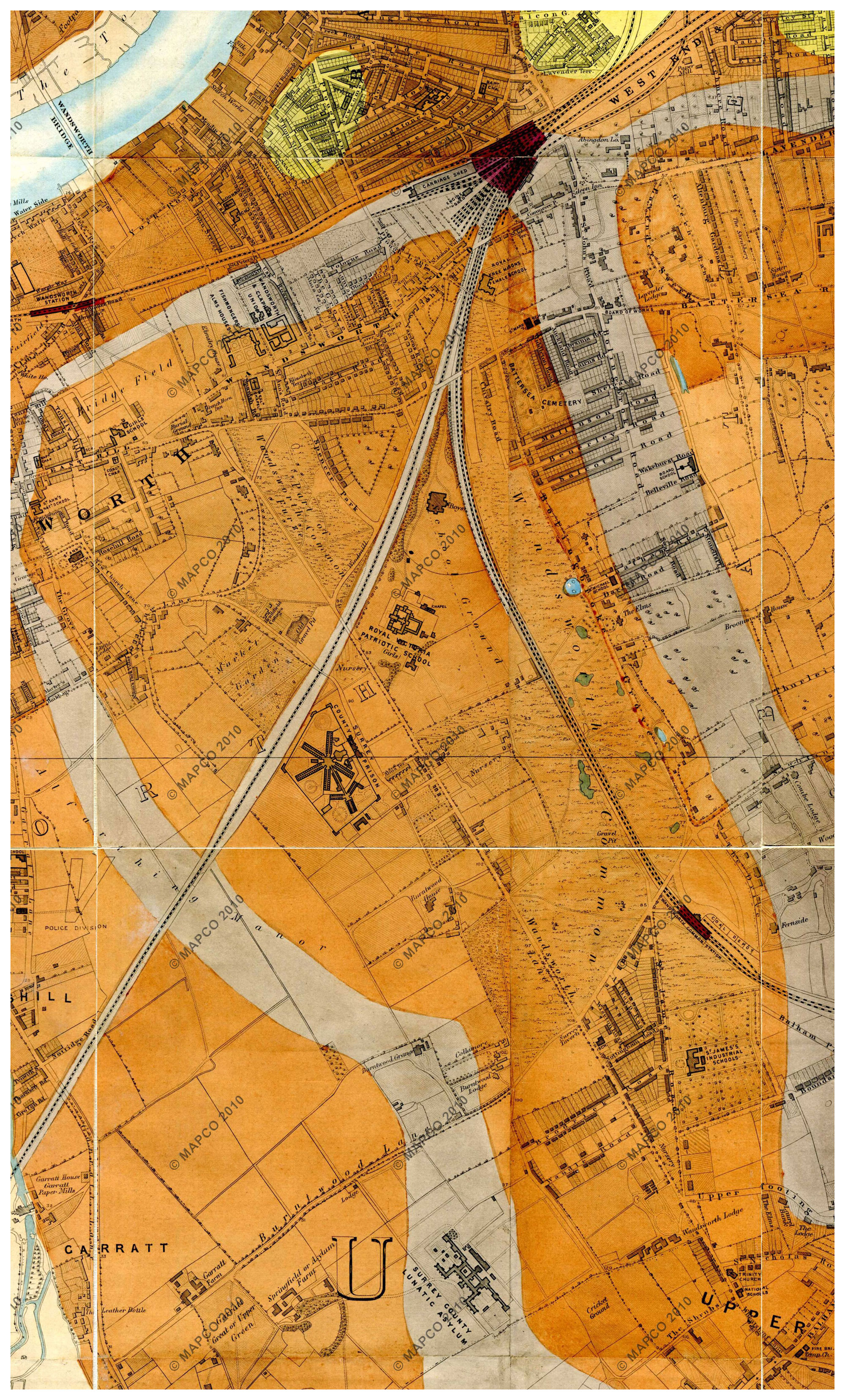
Stanford’s Geological Library Map, 1878. Detail showing Wandsworth Common and its immediate surroundings.
The geological map reveals that Wandsworth Common sits on a terrace of Thames gravel overlying London Clay, with chalk further beneath. The gravel is directly responsible for the pitting, digging and ponding that characterised the Common in its pre-1871 state — gravel extraction was a significant activity here, leaving the landscape of hollows and ponds familiar from the OS maps of 1867–9.
The underlying chalk connects to the story of the Wandle: chalk aquifers filter and purify the river’s water as it flows northward from the Surrey Hills, making the Wandle one of the rarest chalk streams in the world.
[PB: Add further notes comparing the geological colouring with the modern geological map of the area. Cross-reference with the Mylne geological map of 1858 and the Bacon geological map of 1903.]
— london1878.com: Stanford 1878, Sheet 48 (WC North)
— london1878.com: Stanford 1878, Sheet 53 (WC South)
— See also: Other Stanford maps of London
— See also: Mylne, Geological Map of London, 1858
Part of Stanford Maps of London — Wandsworth Common in Maps. Page created June 2026.