
[PB: Several of the maps are in the wrong position, or do not show. They need attention.]
John Rocque (c.1709–1762) was a French-born cartographer who became the pre-eminent mapper of London in the mid-eighteenth century. He produced several maps relevant to Wandsworth Common between 1746 and his death in 1762; his widow Mary Ann carried on the business for a few years, until in the late 1760s she transferred the plates to the publishers Carrington Bowles and Robert Sayer, under whose imprints later editions appeared.
The four maps shown here — 1746, 1754, 1766 and 1768 — form a sequence, and repay close comparison with each other and with later maps. The research notes below treat them as a connected body of evidence rather than isolated documents.
John Rocque, An Exact Survey of the Citys of London, Westminster, ye Borough of Southwark, and the Country near Ten Miles round, 1746. Detail showing Wandsworth Common.
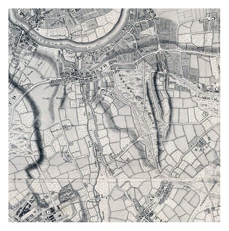
John Rocque, 1746. Wandsworth Common detail.
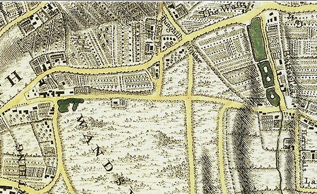
Rocque, 1746. North of the Common, showing Dunghill Square.
Notes on the 1746 map
This is the earliest map (that I know of) that combines the wastes or commons of the two adjacent parishes (Wandsworth East Field and Battersea West Field) as “Wandsworth Common.”
Notice how few houses are shown. The roads or tracks across the Common are a challenge to interpret. Only Burntwood Lane is named. Some roads seem to correspond reasonably well with today’s roads — Burntwood Lane and Nightingale Lane, and the track that joins them (the future Bellevue Road). Also something like Lyford/Heathfield Roads and St Anne’s Hill/North Side. And North Side/Battersea Rise, Bolingbroke Grove.
The most problematical roads are the ones running more or less north–south from Tooting. There is nothing that is clearly “Trinity Road” (a name that wasn’t used until the 1870s, while Thomas Hardy was resident), except at the bottom end (an earlier name for this lower section was Wheatsheaf Lane, possibly after the pub at the corner). The left-hand branch runs to the point where Beechcroft Road (now parallel to Trinity Road) now meets Burntwood Lane.
The most puzzling roads apparently fork somewhere in the middle of the Common. A number of branches to the left veer towards Wandsworth. The main track on the left ends at much the point Trinity Road does now, to reach the main roads between London and Kingston (but veering westward to avoid some large ponds — emphasised in Tirion’s map of 1754). Incidentally, Trinity Road still shows signs of this jink.
But it’s the right fork, leading to Battersea, that is the most intriguing, and for which there appears to be no modern equivalent. This road, which ran along the Wandsworth–Battersea parish boundary, appears in a number of maps in the next 50 or so years (see e.g. Cary 1786, and Faden 1790, which omits the proto-“Trinity Road” entirely), but then disappears. Its only relic (that I know of) is the wide track that runs a few hundred yards behind the Toast Rack garden fences. I wonder if it formerly acted as something of a barrier to encroachment from the west, since this “road” will have been regularly used perhaps for thousands of years. Travellers along it would presumably have resisted incursion over their “desire line.”
Notice Rocque indicates mounds or hillocks, particularly in the north of the Common. In an article about the Mount Pond on Clapham Common, one writer seems to suggest these are old burial mounds (Neolithic? Bronze Age? Iron Age?). He also suggests they were used to establish boundaries between neighbouring parishes. Or are they simply for artistic effect, to evoke the “wildness” of the terrain? Certainly the Common is not flat — this came much later, mainly at the end of the 19th century.
This map was first published by Rocque in 1746, and several editions appeared before his death in 1762. His widow Mary Ann carried on the business for a few years, until in the late 1760s she transferred the plates to the publishers Carrington Bowles and Robert Sayer. Printed in 16 sheets, the map is set within a decorative border. Its title features in English, Latin and French. A key to symbols distinguishing orchards, arable land, formal parkland, pasture and woodland is included.
[PB: Online version at British Library. March 2023: think I now have better versions of some Rocque maps — check and add.]

John Rocque, Map of the County of Middlesex in which parishes are bounded with red to be distinguished from the others, 1754. Detail showing Wandsworth Common.
Notes on the 1754 map
[PB: Compare carefully with the 1746 map. What has changed? What remains the same? Add notes. Online version at British Library: Crace Collection.]

John Rocque, 1766. London and surrounds.
Notes on the 1766 map
The text (top left) declares the map is the work of “J Rocque Chorographer to His Majesty, in the Strand, London 1762. With new improvements to the year 1766.” The map was created explicitly to show how much larger London was at this time than Paris (“the two RIVALS”).
[PB: Compare this map of 1766 with the high-res Rocque map of 1741–5. Possible areas of further encroachment include east of future Bolingbroke Grove and several areas to the west of the Common. Roads increasingly form the boundary of the Common — previously the roads are shown as tracks, with “waste” land on either side. Now fields go right up to roads. The Bern edition of 1766 (below) appears to be a cleaned-up copy of the original 1746 map, not subsequent versions.]
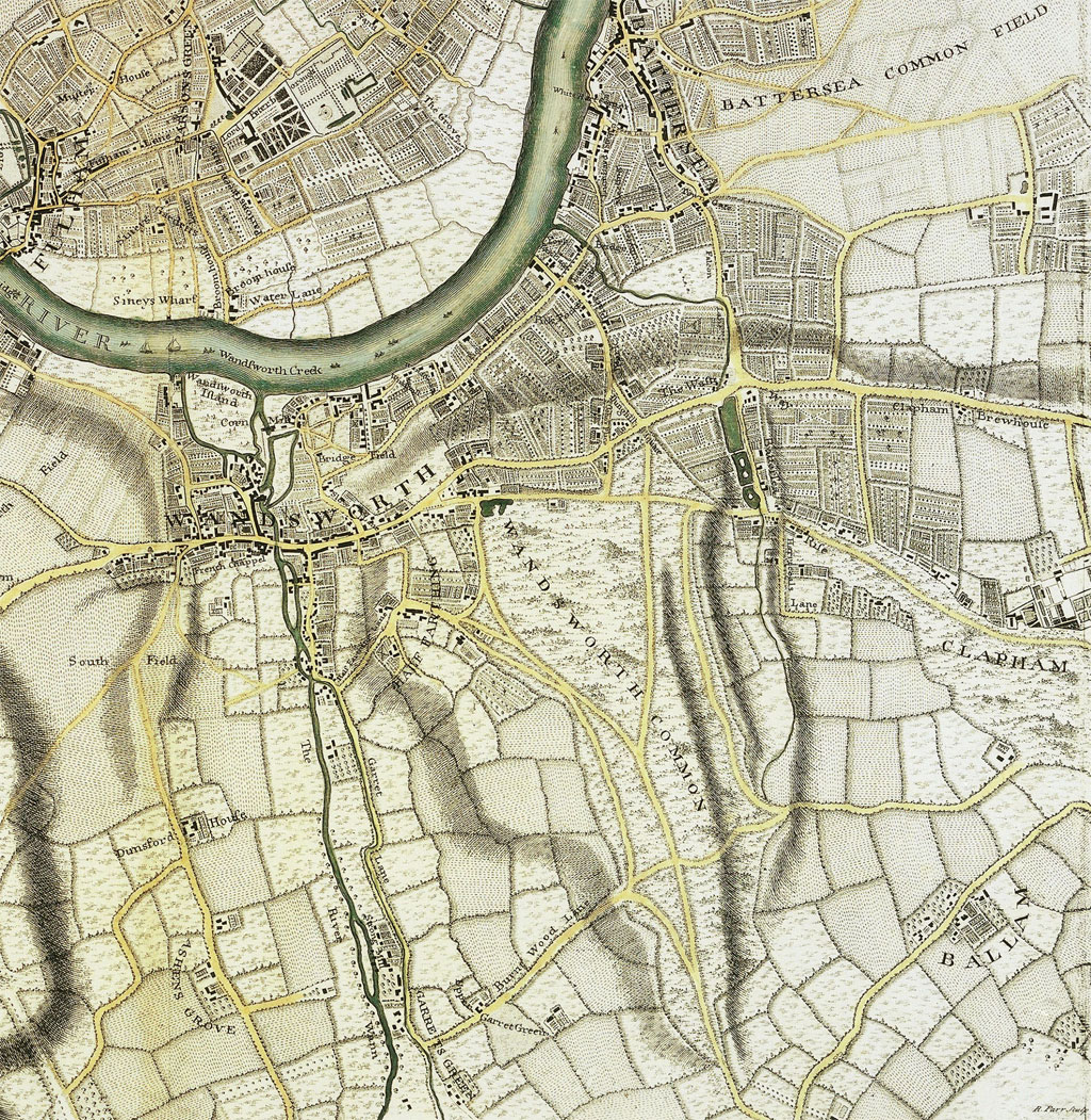
Rocque, 1766. Bern edition. Wandsworth Common detail.
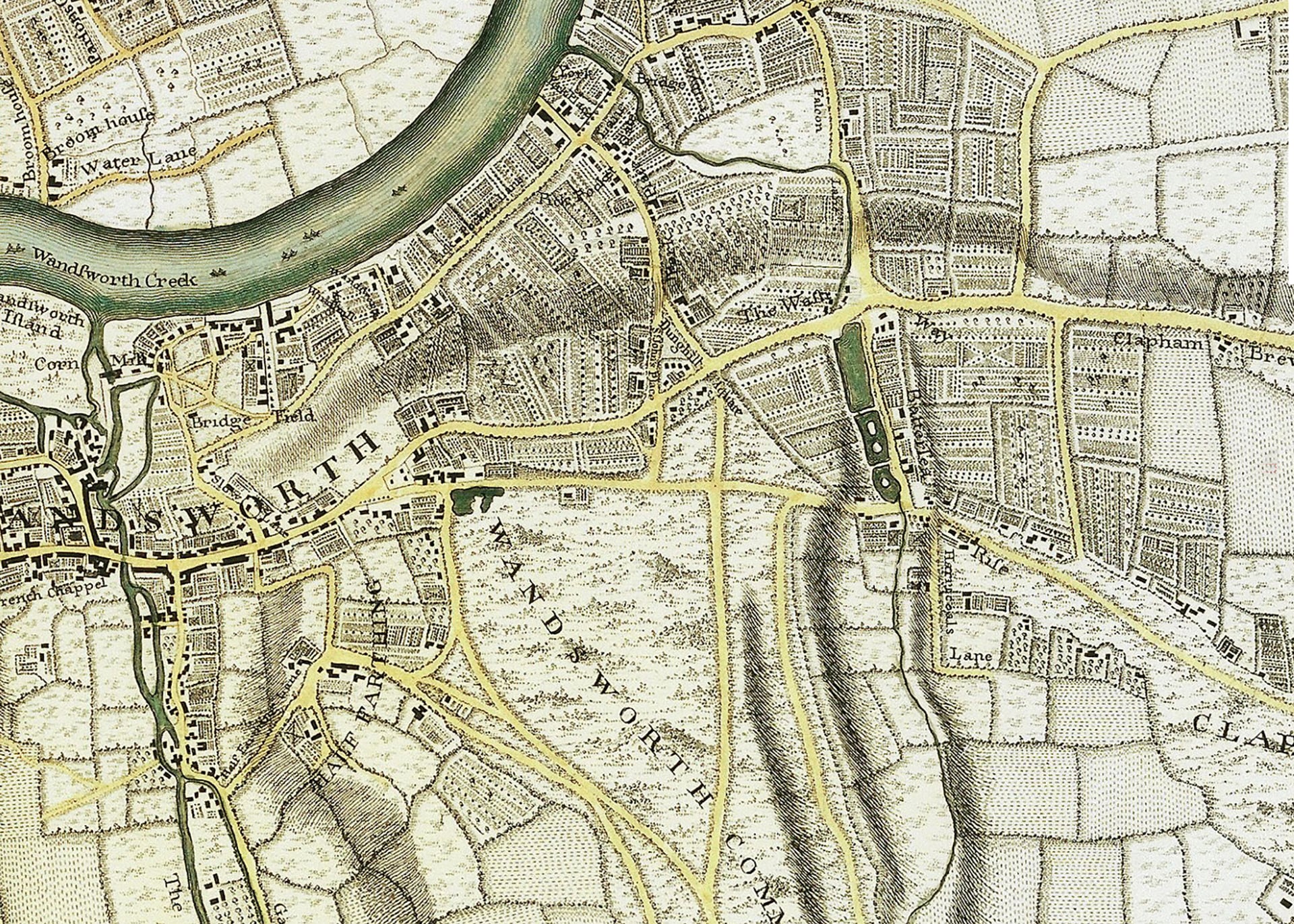
Rocque, 1766. Wandsworth Common: roads and wash detail.
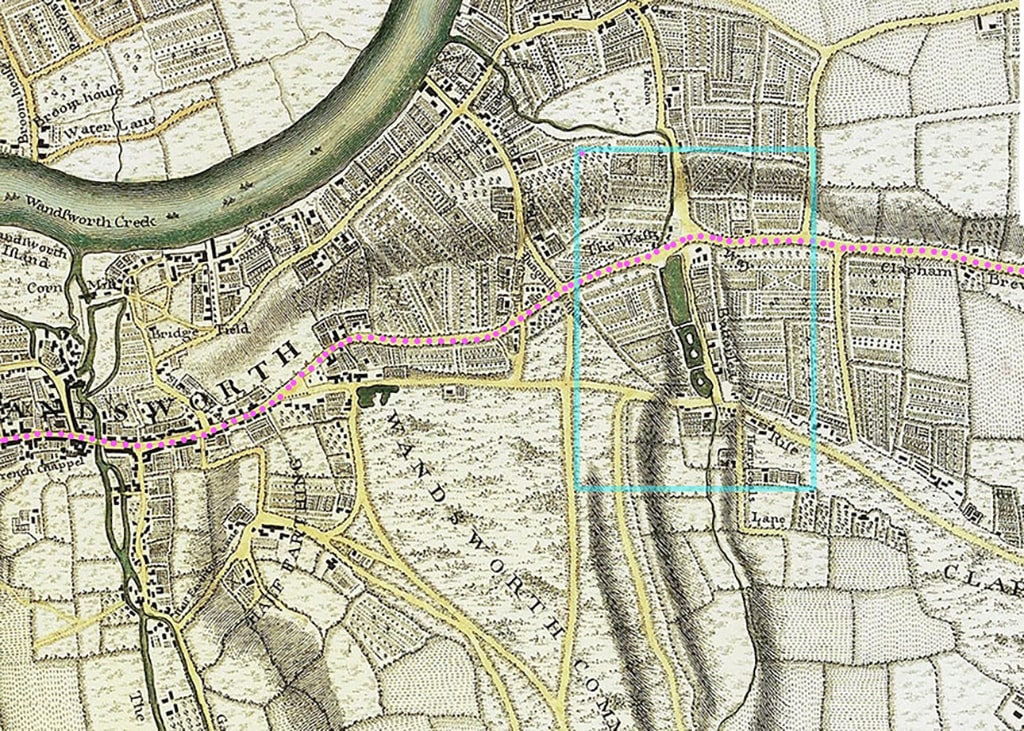
Rocque, 1766. Marked-up version showing roads and wash.
Notes on the Bern edition
My favourite: A high-resolution, nicely coloured edition of this map can be seen online at Bern University. Of which, South-west London.
[PB: The Bern edition appears to be a cleaned-up copy of the original 1746 map rather than the later revised editions. Compare carefully. In June 2026, the link no longer worked. It may have moved elsewhere.]
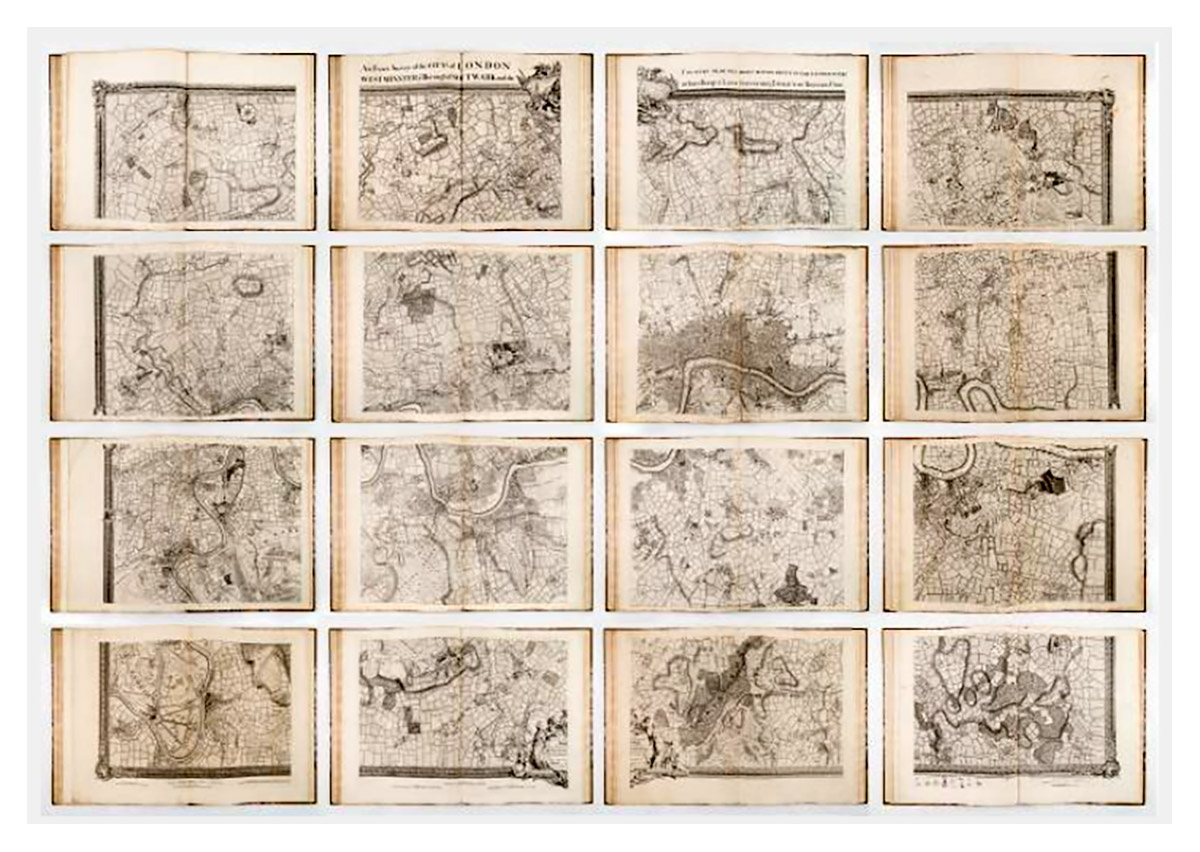
Rocque, 1741-17465: 16 Sheets
Rocque, 1766. Marked-up version showing roads and wash.
An Exact Survey of the City's of London Westminster ye Borough of Southwark and the Country Near Ten Miles Round Begun In 1741 & Ended in 1745 By John Rocque Land Surveyor & Engrau'd By Richard Parr / A New and Accurate Survey Of the Cities of London and Westminster The Borough of Southwark with The Country about it for nineteen Miles in Length and thirteen in Depth...
In 2026, a fine complete version of Rocque's 16-sheet map was online at Barry Ruderman, RareMaps.com.
The text read:
The RareMap.com notes read:
"The First of Two Monumental Maps of London and Environs by John Rocque
John Rocque's 16-sheet map of the area around London, Westminster and the Borough of Southwark represents a triumphant accomplishment in the history of cartography, reflecting an intricate amalgamation of techniques and a wealth of detail that brought the city of London to life in an unparalleled way.
Rocque's 16-sheet map perhaps the finest maps of what is now Greater London published in the 18th Century. Beginning in March of 1737, Rocque would work for nine years to produce the present map of the country ten miles round London on a scale of 51/2 inches to the mile covering what is today's Greater London. Rocque would also publish a 24-sheet map of what is today's central London on a even larger scale.
However, the area covered by the 24 sheet map, capturing urban London in the 1740s, would quickly be outgrown. As such, the 16-sheet map captures many neighborhoods such Chelsea, Hyde Park, West Brompton, Kensington, Earls Court, Islington, Highbury, Notting Hill, Canary Wharf / Isle of Dogs, Clapham, Fulham, Hammersmith, Sheppard's Bush, Holland Park, Battersea, Putney, Richmond, Brentford, Chiswick, Wimbleton, Hampton Court, etc. appear only on the 16-sheet map.
The 16-sheet map vividly demonstrates vividly the development of London's environs with villages and market gardens outside the nucleus of the cities of London and Westminster, their rural locations and a network of roads and tracks - much is part of today's Greater London.
p>Surveying Techniques: A Blend of Innovation and PrecisionRocque's method of surveying for this map was groundbreaking, employing a fusion of ground-level surveying and triangulation. On the ground, Rocque used a compass and a metal chain to measure lengths meticulously. This method was coupled with a more advanced technique of triangulation from high points like church towers. For this, he utilized a telescopic-sighted theodolite made by Jonathan Sisson, a leading instrument maker of the time.
The marriage of these two techniques was no small feat, requiring careful reconciliation between the highly accurate triangulation and the initial ground surveys. The discrepancies that arose needed to be resolved to produce a coherent and precise map. This combination of innovative methods enabled Rocque to create a representation of London that was both expansive and accurate.
p>The 16-Sheet Map: Details and SignificanceRocque's 16-sheet map stands as a remarkable achievement in 18th-century cartography. Covering not only the central parts of London but extending for nineteen miles in length and thirteen in depth, the map provides an intricate overview of the city. This comprehensive survey showcases London's grandeur and complexity, capturing everything from the magnificent palaces of St. James's, Kensington, Richmond, and Hampton Court to the winding lanes, rivers, bridges, woods, churches, gardens, and more. The accuracy and depth of detail in the map are remarkable, making it an invaluable resource for historians and enthusiasts alike.
The publication of the map was an event in itself. The depiction of the city and its surroundings were groundbreaking, representing London in a way that had never been done before.
p>London in the Mid-18th Century: A City in FluxThe map provides a window into London at a transformative period in its history. A growing metropolis, London in the mid-18th century was a city of contrasts, with opulence and poverty existing side by side. Its landscape was marked by both historical grandeur and the bustling activity of commerce and daily life.
Rocque's map captures this duality, presenting a vivid image of London's streets, buildings, and natural features. It is more than a geographical record; it is a social and cultural document, reflecting the city's character, growth, and dynamism.
p>Legacy of John RocqueJohn Rocque, a figure of considerable importance in the history of cartography, left an indelible mark on the mapping of London in the mid-18th century. Born to French Huguenot parents, Rocque's family emigrated to London around 1709, and his life became intertwined with the rapidly evolving urban landscape of England's capital.
Rocque's early life is shrouded in mystery, with little concrete information about his upbringing and education. Despite this, his French background and family connections to engraving laid the foundation for his later career. Rocque was a multifaceted figure, involved in surveying, engraving, mapmaking, and publishing. He began his career with garden designs, working in collaboration with his brother Bartholomew, a landscape gardener, before expanding into the wider field of mapping.
Rocque embarked on the ambitious task of surveying London in 1737, collaborating with John Pine. This colossal undertaking presented numerous challenges, from the financial to the technical. London, with its complex network of roads, lanes, and intricate urban layout, was a challenging subject to capture accurately. The project became strained as the years dragged on, and Rocque found himself in financial difficulties.
However, his perseverance paid off, and the final work was an impressive 16-sheet map, capturing London and the surrounding area with extraordinary detail. Bound as an atlas, the map presented a comprehensive view of the metropolis, including depictions of palaces, roads, rivers, bridges, hills, valleys, woods, churches, gardens, and more. This work and his 24-sheet plan of London solidified his status in the pantheon of London mapmakers.
p>ConclusionJohn Rocque's 16-sheet map is not just a historical artifact but a work of art that tells the story of London and environs in the mid-18th century. It reflects an extraordinary blend of innovative surveying techniques, careful craftsmanship, and artistic vision. From the precise measurements achieved through triangulation and ground-level surveying to the evocative depiction of gardens and grand edifices, the map encapsulates the essence of London in its time.
Its publication marked a new era in cartography and offers an enduring legacy. For anyone seeking to understand the city's landscape, architecture, and spirit during a pivotal era, these maps stand as a testament to the blend of science and art that defines map-making at its best. The map remains a fascinating and valuable resource, a tribute to a city's complexity and the timeless pursuit of capturing it in all its nuance and grandeur.
p>John RocqueJohn Rocque (circa 1704-1762), an 18th-century surveyor of Huguenot descent, left a profound imprint on the topographical representation of England, particularly through his elaborate maps of London and its surroundings. Despite his significant contributions, his life, both personally and professionally, remains somewhat cloaked in mystery.
Born likely around 1704 or 1705 to French Huguenot parents who migrated to Geneva following the revocation of the Edict of Nantes, Rocque found his calling in England. There, he and his siblings were known to have spent significant parts of their lives. His journey into surveying took off in 1734, with his first recognized work involving a survey of Richmond House and its gardens. This engagement emerged at a fortuitous time when the landscaping and design of the nobility's estates were witnessing renewed interest, which required accurate surveying—a skill Rocque exemplified.
Rocque didn't confine his talents to surveying alone but ventured into printselling, owning a shop near Hyde Park Corner by 1743. This enterprise reflected his energetic nature and the breadth of his ambition, contributing to his reputation for high-quality work, evidenced by the size of his workforce, which included up to ten draughtsmen and engravers at times.
In his later years, Rocque faced adversity, with his shop and entire stock in Whitehall being devastated by fire in 1750. However, his resilience saw him bounce back, and despite several relocations, Rocque maintained his business operations around the Strand area. By the 1750s, his work had taken him to Dublin, where he made substantial contributions in the form of numerous Irish maps and various English county maps.
On the personal front, Rocque married twice but had no known children from either marriage. His first wife was Marthe, whom he married by 1728, and following her death, he married Mary Anne Bew in 1751. Rocque's health began deteriorating towards the end of his life, leading to his death on January 27, 1762. His widow, Mary Anne, continued to manage the business for several years after his demise.

John Rocque, 1768. Wandsworth Common detail.
Notes on the 1768 map
[PB: Check date and source. Compare this map of 1768 with the high-res Rocque map of 1741–5. Possible areas of further encroachment include east of future Bolingbroke Grove and several areas to the west of the Common. Roads increasingly form the boundary of the Common — previously the roads are shown as tracks, with “waste” land on either side. Now fields go right up to roads.]
John Rocque (c.1709–1762) was born in France of Huguenot descent and came to England as a young man, eventually becoming “Chorographer to His Majesty” (George III). He is best known for his large-scale survey of London (1746) and his county maps. His maps are among the most detailed and artistically accomplished of the 18th century. After his death in 1762 his wife Mary Ann continued the business; the plates eventually passed to Carrington Bowles and Robert Sayer.
[PB: Add further biographical notes and links to standard references.]
In June 2026, there was a rather fine reduced single-sheet version of the 16 sheets combined online at .
— British Library: Rocque 1746
— British Library: Rocque 1754 (Crace Collection)
— Bern University: Rocque 1766 (high resolution)
Part of Wandsworth Common in Maps. Page created June 2026.