Working titles
— [TITLE] "The Evolution & Evolution of Wandsworth Common"
Probably best to think of two distinct sections/books:
— I. The Common — size — structure — topography — elevation — geology — hydrology — vegetation — insects — birds — mammals
— II. The institutions, estates and houses on and around.
Perhaps even three:
— II. The people — how the common evolved / was saved / by whom / how governed etc
- Early / Westminster etc
- Bolingbrokes
- Spencers
- Conservators
- MBW
- LCC
- WBC
Perhaps think about the difference between "anatomy" and "evolution"?
— Links
— How large was WC? Where were its edges? The extent of the Common on early maps
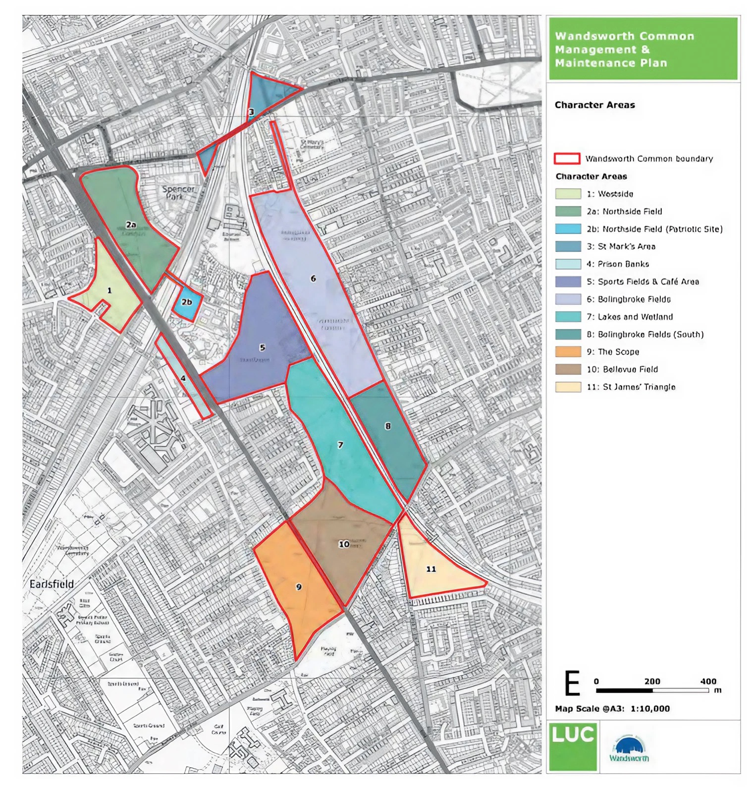
— 2b — North Side (Patriotic Site)
— 6 — Bolingbroke Fields (North)
— 8 — Bolingbroke Fields (South)
The little bits / fragments
— Roads
— The ghost main road across the Common
— Ghost corner of Nightingale/Bolingbroke
— Paths
— Paths
— Paths
— Paths
— [Southampton and south-west]
— [Crystal Palace and Brighton]
— Railway bridges — Bellevue/Nightingale Lane
— Railway bridges — Heathfield Road
— Railway bridges — Trinity Road
— Railway bridges — Battersea Rise
— Railway bridges — Boutflower Road
— Water
— The Lake
— Underground pipes, sewers etc
— Trees, shrubs, flowering plants, other
— Poplars
— Hawthorn
— Oaks
— Gorse
— Grasses
— Areas
- the bird-beak/V-shapes [or cover in Roads?]
- the changing parish & borough/constituency boundaries
— Heathfield Cottages [Keith Bailey]
— West including West Side [Keith Bailey]
— Chivalry Road [Keith Bailey]
— Spencer Park [Keith Bailey]
Kite — RVPA Girls (reused for 3rd General Hospital, WWII, Honeywell/Spencer Park School etc RVPA Boys/Emanuel — Fitzhugh — the new estate
Toast Rack
— Houses (and creeping enclosure)
— Parish and electoral etc boundaries
— Features
- distinguish Landscape features from structures?
— Windmill
— Refreshment house/ Neal's Farm/Lodge
— Shelters
— The Cricket Field / Enclosure
— Link
— Prison
— St James's Industrial School
— Royal Masonic School for Girls
— Link
— Link
— Link
— Link